Situation Overview We're beginning to see the squall line to our west become better organized
⚠ 8:20am ET/7:20am CT - Situation Overview
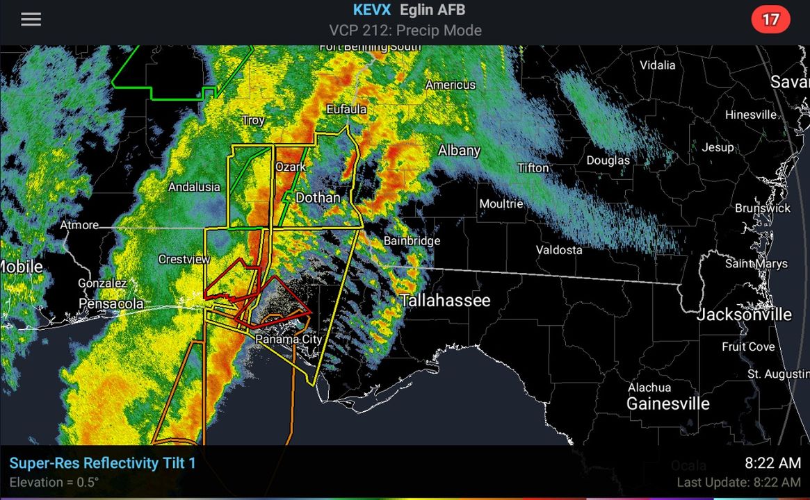
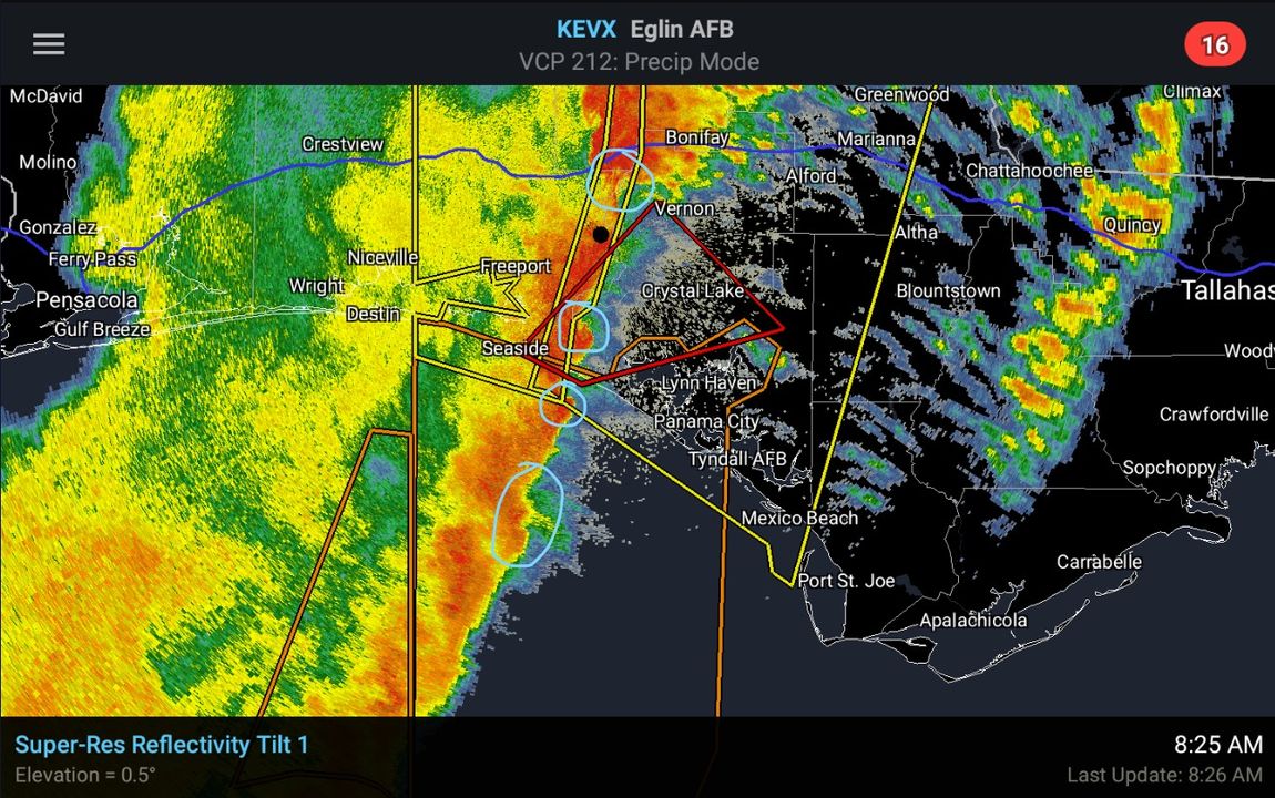
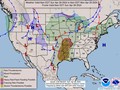
We're beginning to see the squall line to our west become better organized. In addition to the damaging wind threat, we're also seeing a few embedded circulations along the line (circled in the radar screenshot). These can spin up quickly with little warning time, so take warnings seriously!
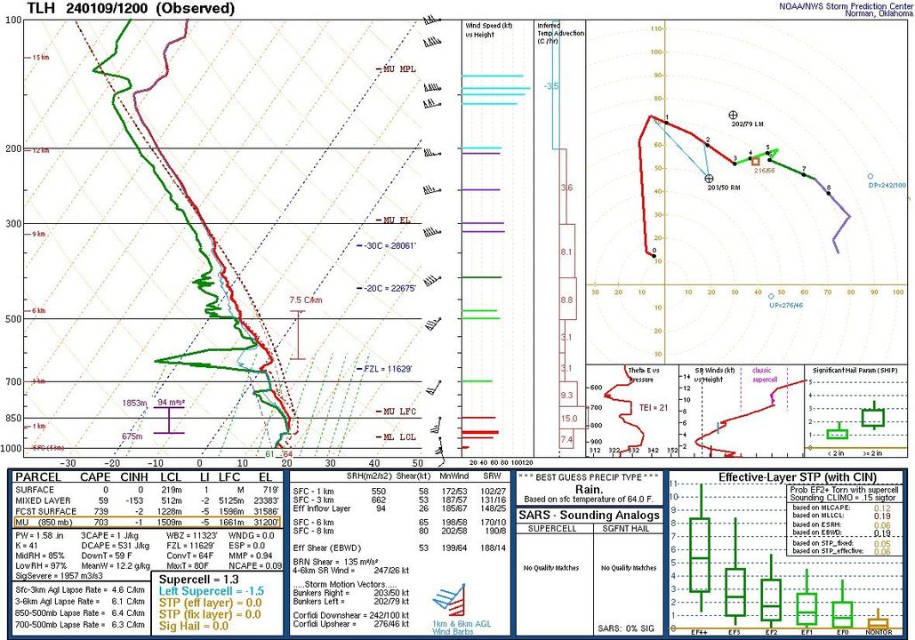
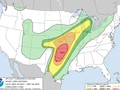
Additionally, looking at our morning balloon launch we are wanting to point your attention to the high winds just immediately off the surface. We have 70 knot (80 mph) winds about 3,000 ft above the surface. As things warm up ahead of the squall line, this is where the intense winds ahead of the squall line are likely to impact folks in the next few hours. These gusts could near 40 to 55 mph and these are *before* the squall line brings potentially higher gusts as it plows through the region.
A tornado watch remains in effect.
#FLwx #GAwx #ALwx
|
|
Weather searching weather forecast for all cities in the world.
The second option is to search through list of continents and countries.
